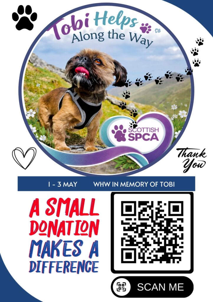
1–3 May 2026
164 km / 34 h
Introduction
Tobi was our beloved little dog — not just a companion and a friend. We treated him like our canine son, and that is who he will always remain in our hearts. When we learned he had lymphoma, our world collapsed… How was it possible? Why did such a good, innocent creature have to suffer so much? We could not comprehend it, and to this day we cannot truly accept that he crossed the Rainbow Bridge. He left behind unconditional love, a desire to do good, and the inspiration to become better people — for one another and for others. Everyone who knows me knows that Tobi was unique, my one and only canine son.
Tobi was an incredibly active and curious little dog. Full of energy and joy. He taught us how to love unconditionally and how to appreciate every single day. He could comfort us during difficult moments, lift our spirits, make us laugh, and bring genuine happiness into our lives. He was deeply attuned to our emotions and was a loving, loyal, devoted friend.
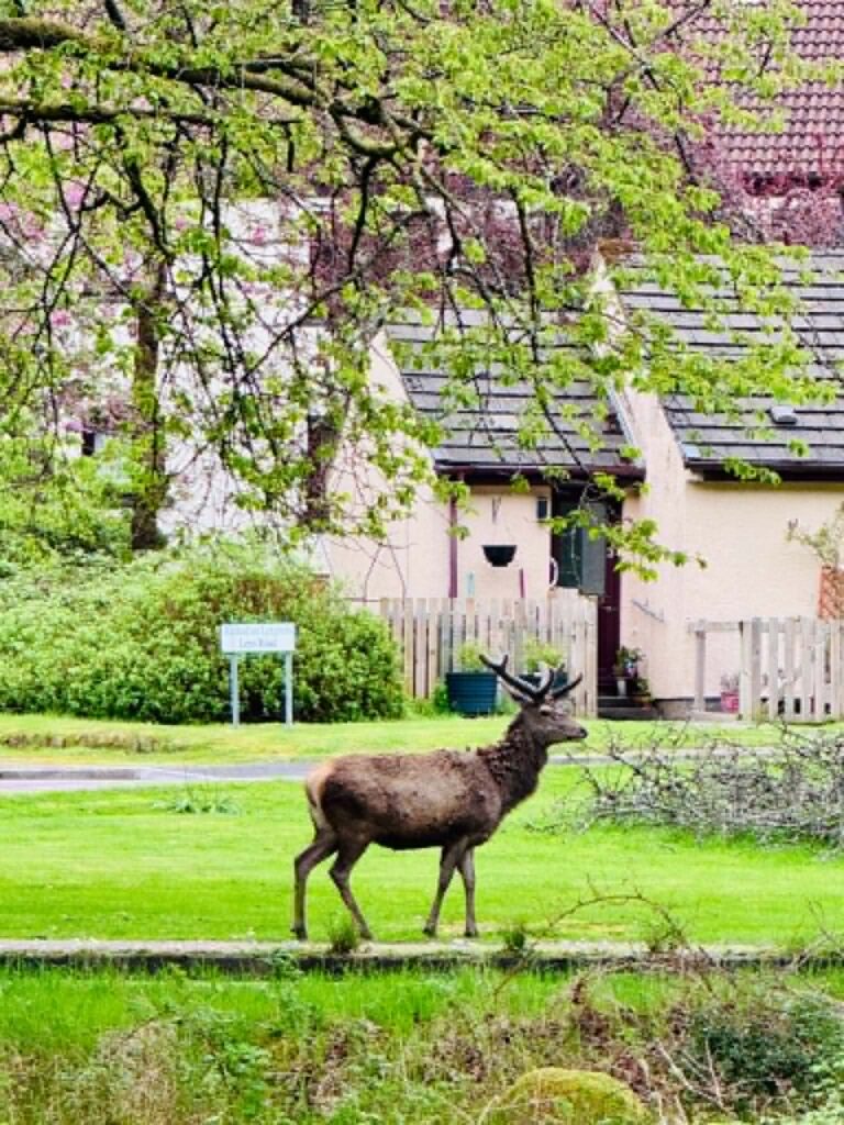
Tobi climbed Scotland’s highest Munros with us, walked along cliffs, mountains, parks, and forests. The North Coast 500 became our favourite holiday route. That was when I discovered that he absolutely loved swimming 😊 Our tiny Shih Tzu. He was always with us whenever we travelled around Scotland in our campervan, and later in our motorhome. He was a travelling dog, an explorer, a conqueror. He loved nature just as much as we did, and he felt happiest surrounded by it.
Tobi also knew certain sections of the West Highland Way. We used to walk them whenever we planned to climb nearby Munros. When he crossed the Rainbow Bridge, a project was born inside me:
“Tobi Helps Other Dogs Along the Way – The West Highland Way in Memory of Tobi – Raising Money for Scottish SPCA.”
A journey across the WHW to honour Tobi, while helping raise money for dogs in need. Charity challenges like this are very popular in Scotland.
My beloved Robert — Tobi’s dog dad — who had completed the WHW three times already (both on foot and by bike), said to me:
“Darling, you can absolutely do it in three days.”
And that is how it all began.
He planned the route and promised to support me throughout the challenge. It was meant to be a challenge. For Tobi. And for all the dogs.
I contacted the Scottish SPCA and created a fundraising page, which can still be found here:
Robert worked tirelessly to help me raise money for dogs in need, and at this point I would like to thank him — and everyone who donated to this beautiful cause:
YOU ARE ALL WONDERFUL.
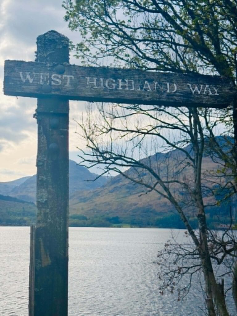
What Is the West Highland Way?
For those who know nothing about this route.
The West Highland Way is Scotland’s first long-distance walking trail. It stretches for 96 miles (154 km). It officially opened in 1980.
The trail begins in Milngavie (a suburb of Glasgow) and leads all the way to Fort William, home to Scotland’s highest mountain — Ben Nevis (1,345 m above sea level).
The creator of the route was Tom Hunter (1926–2016), an RAF serviceman and passionate lover of hiking and Scotland’s wild landscapes. The idea first emerged in the 1940s, but bringing it to life took decades. It required painstaking negotiations with landowners and endless bureaucracy.
A key role was also played by geographer Fiona Rose, who, during the 1970s, walked more than 1,600 km in order to precisely map the route.
The trail officially opened on 6 October 1980.
Traditionally, the West Highland Way is divided into eight stages, allowing hikers to complete it comfortably over 7–8 days. The trail runs south to north, beginning in gentle Lowland terrain before gradually transforming into increasingly demanding mountain landscapes.
Online, you can find both the classic 8-day itinerary and shorter 5-day versions. For anyone interested, here is a link with detailed information about the WHW and how to plan your ideal route:
https://www.walkhighlands.co.uk/west-highland-way.shtml
Robert planned my route over three days — because this was meant to be a challenge.
Why a 3-Day Challenge?
Now comes a very personal paragraph 😊
The WHW in 3 days — it was meant to be a challenge. A conscious one. Harsh. A little uncompromising.
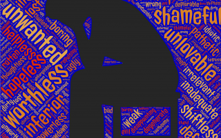
I did not choose to complete the West Highland Way in three days by accident. I wanted to feel pain. To discover where my limits truly were. To see how much I was capable of carrying physically, since emotionally everything inside me had already fallen apart after Tobi died and grief consumed me.
I did not understand this before setting off. Only during the challenge did I realise how deeply my subconscious had been guiding me.
Tobi had cancer. I watched him suffer — day after day — with no shortcuts, no relief, no possibility of simply “switching off” the experience. Somewhere inside me, a hidden need emerged: to come a little closer to what he had felt.
Not to understand it — because that is impossible.
But perhaps to touch it, somehow, through my own body.
Through exhaustion. Through pain. Through pushing myself beyond my limits.
This journey also became a symbol.
Not only for Tobi, but for all dogs who suffer and need help. Their pain often happens quietly — unseen, unnoticed, not considered important enough.
These three days became my way of giving that suffering meaning.
During the walk itself, things became strangely simpler. My body hurt, my breathing became heavy, my legs stopped cooperating, my feet — covered in blisters — burned like fire… yet my mind fell silent.
Grief retreated somewhere into the background, buried beneath sheer physical effort.
It only resurfaced in places where Tobi and I had once walked together.
If I am honest, the challenge became a kind of escape — even if not entirely conscious.
I replaced one pain with another. One that was more tangible. More manageable.
And when I finally reached the end, there was nowhere left to run.
One final photograph at the finish line… and then tears. Despair.
I cried for a very long time. As if I were releasing everything I had suppressed over those three days.
The emotions returned with double the force — raw, real, impossible to bury beneath another kilometre.
I could not stop crying.
(…)
Robert understood. He was there. Supporting me, as always.
Thanks to him, this grief remains bearable.
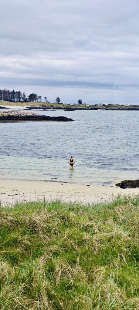
And then I walked into the ocean.
The freezing water stole my breath away, yet somehow it also brought order to the chaos inside me.
I swam. I submerged myself. As though I were trying to wash away the weight of those days — not only the three WHW days, but everything since the diagnosis — or perhaps trying to give it meaning I had not been able to find before.
And there, somewhere in that silence, after everything…
IT APPEARED.
MEANING.
For those interested in taking on a similar three-day challenge, below I will describe my adventure.
DETAILS OF THE 3-DAY WEST HIGHLAND WAY ROUTE
Stage I / Day 1
Milngavie – Beinglas Farm – 64 km
I actually completed 70.2 km in 16 hours (including breaks). The AllTrails app showed that I had been moving for 14 h 12 min.
Why?
Because several times I wandered off the official route to explore the surrounding areas.
Stage II / Day 2
Beinglas Farm – Glencoe Ski Resort – 46.5 km
Including my “exploring detours,” my route measured 49.9 km.
12 h 38 min total. 10 h 43 min moving time.
Stage III / Day 3
Glencoe Ski Resort – Fort William – 40.5 km
My route with “extra sightseeing” totalled 43.9 km.
10 h 28 min total. 9 h 14 min moving time.
Altogether, my WHW became:
164 km / 102 miles
(meaning I added roughly 10 extra kilometres throughout the entire route).
STAGE I / DAY 1
Milngavie – Beinglas Farm – 64 km (my 70 km)
Milngavie in the early morning was wrapped in soft darkness. At 5 a.m., the photo session at the starting point looked slightly grey and gloomy, but inside my heart there was light illuminating the entire journey.
Robert kissed me for luck, and Tobi accompanied me in every step of the hike.
I was not alone.
The route was relatively flat at first. The first 40 km felt like an easy walk. It rained a little, but this was Scotland after all — the weather is famously “patchwork.”
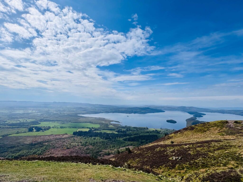
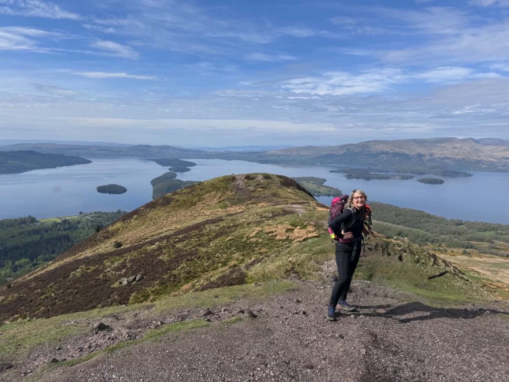
A wonderful highlight was climbing Conic Hill (361 m above sea level). It is a very special place where the Scottish Lowlands transition into the Highlands.
You can bypass the hill entirely — the WHW officially avoids the summit — but I would not have been myself if I had not climbed to the top to admire the breathtaking views.
People often say that Conic Hill offers one of the most beautiful panoramas in Scotland: the southern reaches of Loch Lomond and the distant peak of Ben Lomond.
If any of you would like to hike this hill one day, I highly recommend taking the trail from Balmaha.
(It is also dog-friendly.)
At the summit I met one adorable dog that I simply could not stop petting and hugging.
I could feel Tobi’s energy.
Descending into Balmaha, I discovered a lovely place to eat lunch:
or to grab coffee at St Mocha Coffee:
www.theoaktreeinn.co.uk/st-mocha-coffee
where they serve homemade ice cream and quick snacks.
Balmaha is also home to a monument dedicated to Tom Weir — the famous mountaineer, writer, and television presenter — depicted wearing his iconic woolly hat (“woolly bunnet”) and mountain gear.
Tom Weir played a huge role in popularising both the WHW and Scotland’s natural beauty.
What else is worth knowing about this little village?
Loch Lomond Ice Cream is produced locally in Balmaha using milk and cream from nearby farms. Production takes place in the modern Lomond Kitchen facility.
I will definitely return one day to try it.
While resting in Balmaha, I drank delicious coffee and ate an amazing bread roll prepared for me by Robert.
Those rolls are quite extraordinary — but I will keep their story to myself 😊
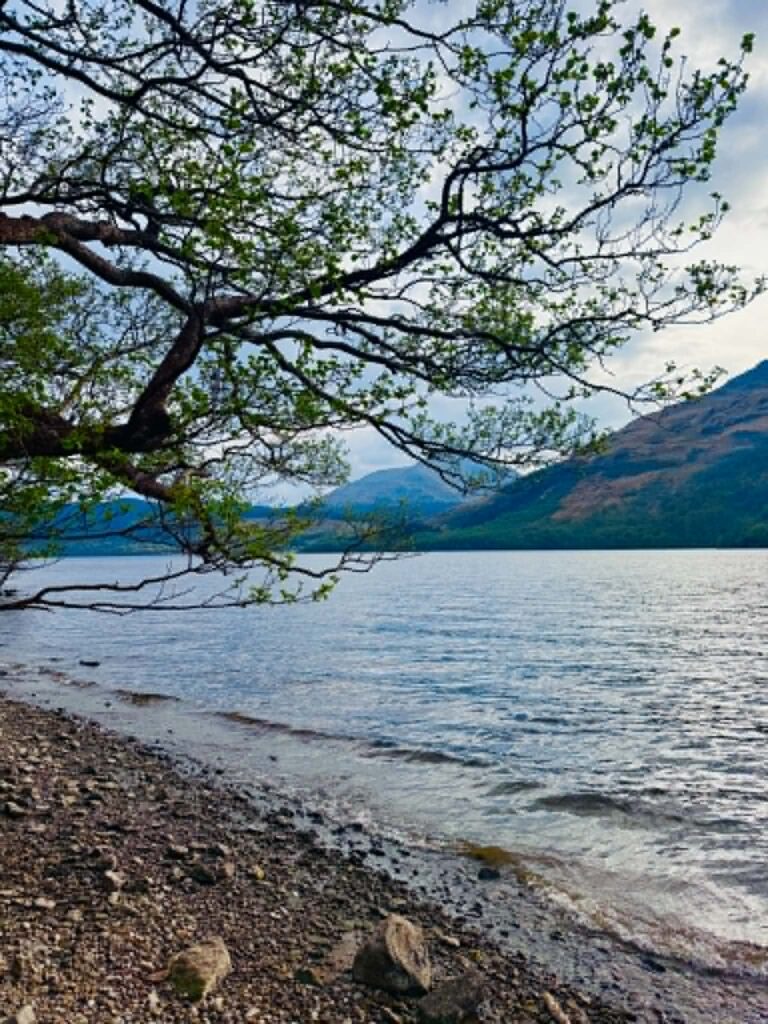
From Balmaha, I continued towards Rowardennan.
This is one of the most beautiful sections of the route.
The trail follows the eastern shore of Loch Lomond, passing charming coves and beaches inviting hikers to rest.
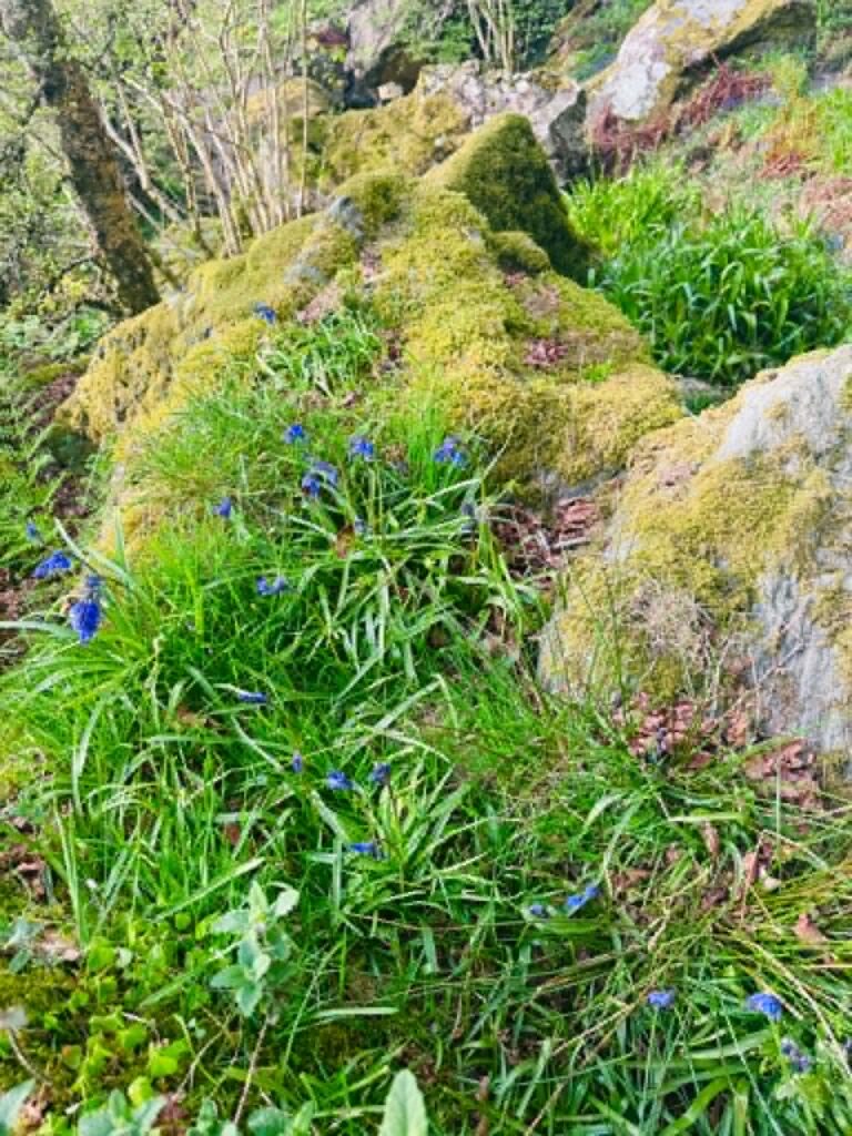
The path also leads through ancient Atlantic oakwoods — absolutely magical at this time of year — forming part of the Loch Lomond National Nature Reserve.
The area is filled with mosses, ferns, lichens, and carpets of bluebells.
The magic of the forest and the beaches of Loch Lomond transported me into the fairytale world of the WHW.
Ben Lomond (974 m above sea level) grew ever closer on the horizon.
Eventually, I reached Rowardennan.
You can stay overnight there, and honestly, I recommend it.
But I had different plans.
I wish I had decided to change them 😊
Because the additional 20 km to Beinglas Farm cost me dearly — several horrible blisters on my left foot, badly chafed feet, and damage to the big toenail on my left foot.
Physically, my endurance was still fine.
My determination to continue never disappeared.
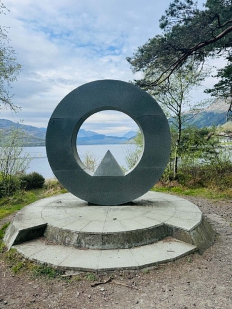
I even left the trail briefly to see a viewpoint featuring a three-metre granite sculpture created by Doug Cocker.
The artist designed it so that its shape perfectly “frames” the distant summit of Ben Vorlich (985 m).
It is a war memorial dedicated to soldiers who gave their lives in service to their country, particularly during World Wars I and II.
The entire area surrounding Ben Lomond was designated a national memorial park in 1995.
This is one of the most photogenic places around Loch Lomond.
My navigation app showed that I had already completed around 50 km and still had 20 km left.
The weather was beautiful, and somehow I completely missed the fact that the section from Rowardennan to Beinglas Farm (Inverarnan) is considered the “hardest 22 kilometres” of the entire West Highland Way.
This is where the comfortable paths end and the real test of character begins.
Walking speed drops dramatically here.
The trail twists along the edge of the loch, filled with exposed roots, slippery rocks, endless ascents and descents.
It requires total concentration to avoid twisting an ankle.
To be fair, there is an alternative High Road route — a wider gravel path through the forest.
It is easier and faster.
But I wanted nature. I wanted breathtaking views.
And I got them 😊
Remembering Robert’s words that the WHW was “almost flat,” I could hardly believe I was on the correct trail.
This was no flat route. Not for a single second.
It was a labyrinth of exposed roots, slippery boulders, muddy holes — one wrong step and you could easily twist an ankle.
Twenty-two kilometres across terrain like that, after already walking 50 kilometres earlier that day, is a terrible idea.
I do not recommend repeating it.
This was the moment when I began swearing a little.
I was angry with myself for not researching this section properly and for underestimating it.
But this was meant to be a challenge.
This was where I was supposed to feel pain, sweat, and tears.
This was where I was meant to battle myself and my grief.
This was where meaning was supposed to emerge — although I could not yet see it.
(I only understood the meaning of the three-day WHW after finishing the journey, as I wrote earlier. At that point, I still did not know.)
I passed hidden tiny stony beaches that I know I will return to one day.
Wild landscapes. A jungle in the heart of Loch Lomond.
At one especially enchanting place, I stepped down onto the sand and wrote my dog’s name:
TOBI.
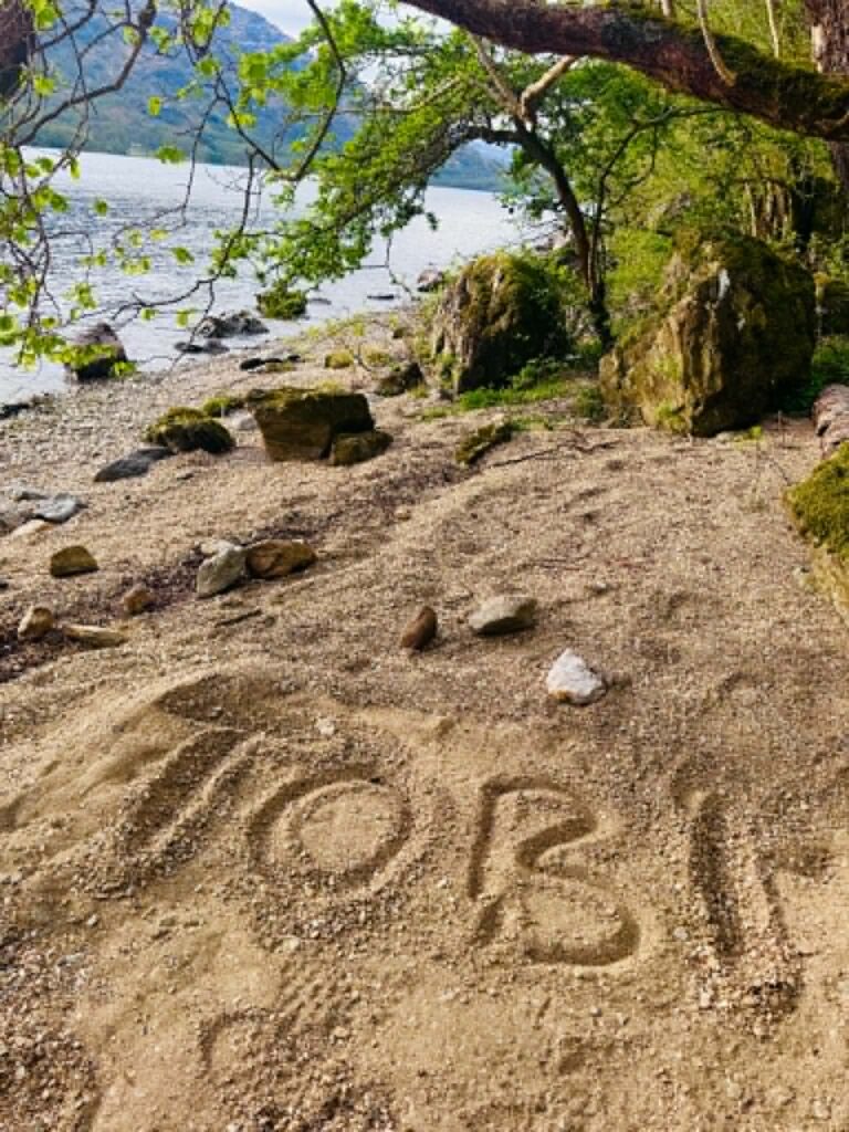
How much I miss you. How desperately I wish you were here beside me right now.
For the first time, tears began to fall.
Still, I kept walking.
The blister on my little left toe became unbearable and I began limping.
Completely limping.
But even with an injured foot, I refused to give up.
The beautiful scenery, carpets of flowers, rocks, and mosses seemed to whisper:
“Not much farther now.” 😊
I also encountered the famous feral goats with their long shaggy coats and enormous horns that have inhabited these shores for centuries.
As I walked and admired the landscape, I finally saw the Inversnaid Hotel and the spectacular Arklet Falls.
I knew then that Beinglas Farm — where Robert, a hot shower, and a delicious dinner awaited me — could not be far away.
I sat down on a bench outside the hotel, pulled out a bread roll, water, and snacks, and slowly ate while admiring the stunning view.
When I finished eating and tried to stand up, I felt a sharp pain explode through my left foot.
Alright. Time to see what was happening.
I will spare the details, but things were not good.
My “special missions” first-aid kit proved invaluable.
After a while, I continued onward.
With difficulty.
The stretch from Inversnaid Hotel to Beinglas Farm was the final section of what became my “hardest day” on the trail.
Although Loch Lomond slowly disappeared behind me, the path refused to surrender until the very end.
“Flat,” of course.
Eleven more kilometres of suffering.
Up and down. Across exposed stones, rocks, roots, muddy patches.
The pain in my feet — both badly chafed — together with the blisters, blood, and sweat seemed to speak to me:
“It’s okay. You can do this. Soon you will rest. You have already completed 59 kilometres.”
I felt tempted to hide away inside Rob Roy’s Cave, which I passed along the route.
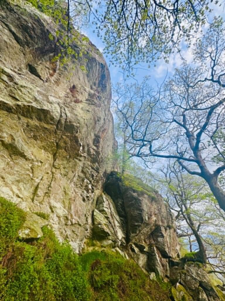
The cave lies around 1 km north of Inversnaid beneath a steep cliff.
According to legend, Rob Roy hid there from the Duke of Montrose’s men in the early 18th century, while being hunted for debts and cattle theft.
Tradition also claims that centuries earlier, in 1306, King Robert the Bruce sought shelter in this same cave after his defeat at the Battle of Dalry.
The cave can also be seen during sightseeing cruises on Loch Lomond (for example with Cruise Loch Lomond), which allows visitors to avoid the difficult rocky hike.
Above the cave I found a quiet place to meditate.
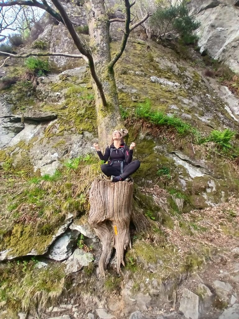
I needed that meditation desperately in order to survive and keep moving 😊
Later along the trail, I passed people setting up tents and preparing for sleep in the forest.
Some were resting with books, soaking their aching feet in the loch.
How jealous I was.
One hiker asked me about my route for the day — how far I had walked and where I was still heading at that hour.
When I told him, he summed me up in one sentence:
“You are mental.”
He was probably right.
I changed my dressings twice during the final section.
Robert began worrying and appeared on the trail about 50 minutes before the end of my hike to carry my backpack for me.
I was incredibly grateful.
By then, the landscape had changed dramatically.
Loch Lomond was now behind me.
Ahead stretched the grassy valley of Glen Falloch, surrounded by massive mountain peaks.
It was the sign that I was finally entering the true heart of the Highlands.
Descending into Beinglas Farm in Inverarnan felt like a signal that rest was finally near.
After a hot shower and treating the wounds on my feet, I simply collapsed…
And then spent the entire night unable to sleep.
The farm buzzed with life.
You could immediately feel that it was a legendary place where exhausted travellers from all around the world gathered together at The Stagger Inn bar.
There was a unique atmosphere of relief after completing the most technically demanding section of the entire route.
Robert managed to collect several more donations for dogs in need.
Meanwhile, I tried to gather my thoughts.
During the night, I stepped outside our motorhome for a moment to admire the stars and breathe in the Scottish air.
To think about Tobi.
And about what would happen at 6 a.m. when the alarm clock rang.
After returning to bed, I finally fell asleep.
And when I woke up, my very first thought was:
“I’m not going any farther. I’m staying here and taking a break.”
My swollen feet begged me to do exactly that.
But coffee and a delicious breakfast worked their magic.
Time for Stage II.
STAGE II / DAY 2
Beinglas Farm – Glencoe Ski Resort – my 59 km
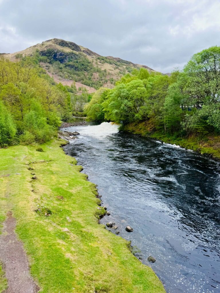
I left the farm limping, but the path was wide and relatively flat. The Glen Falloch valley, running alongside the cascading River Falloch, offered a gentle and comfortable trail, while the greatest attraction of this part of Scotland is undoubtedly the Falls of Falloch waterfall, visible from a slight distance. I will probably return there one day to admire it properly up close.
The route rose and dipped gently, while majestic mountain peaks appeared in the distance.
After around 20 km that day, Tyndrum became my mandatory coffee stop at the famous Real Food Café, where I ordered delicious coffee and the best scone I have ever eaten in Scotland — raspberry with white chocolate! Apparently, the café is also renowned for serving some of the best fish and chips and homemade baked goods in the country.
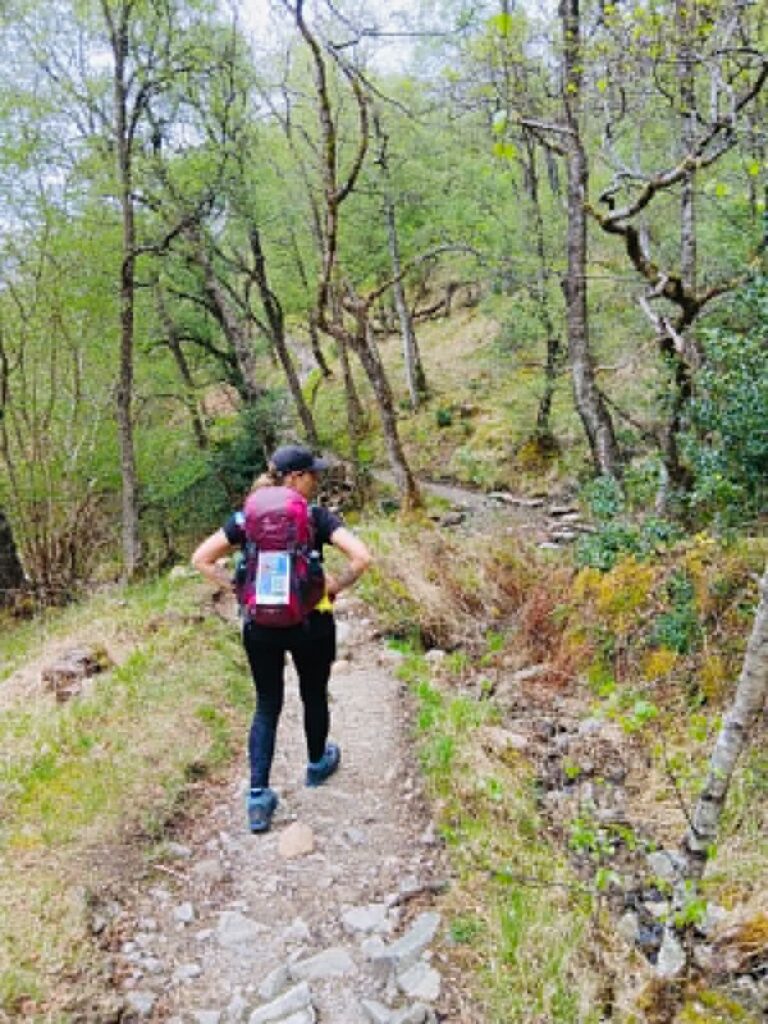
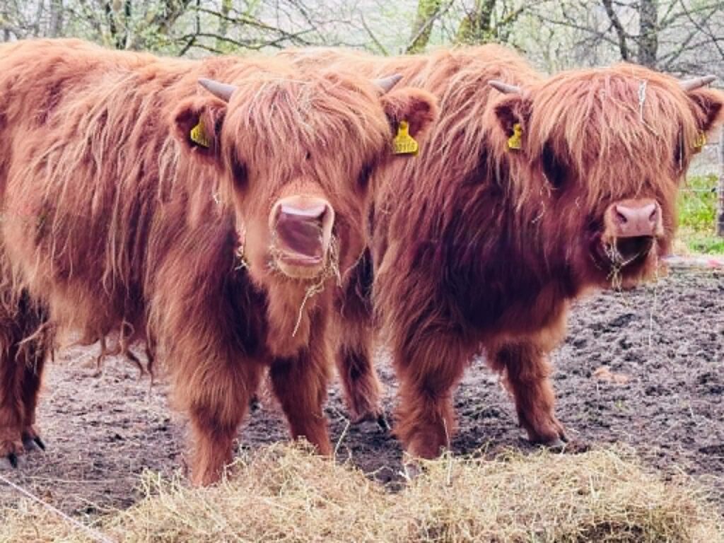
From Tyndrum, I continued onward. I passed Highland cows, small farms, and followed peaceful country paths.
My next stop was Bridge of Orchy.
Naturally — for coffee 😊
The trail circles the majestic cone-shaped mountain Beinn Dorain (1,076 m above sea level). The path follows an old military road, smooth and steady, opening onto vast, breathtaking landscapes.
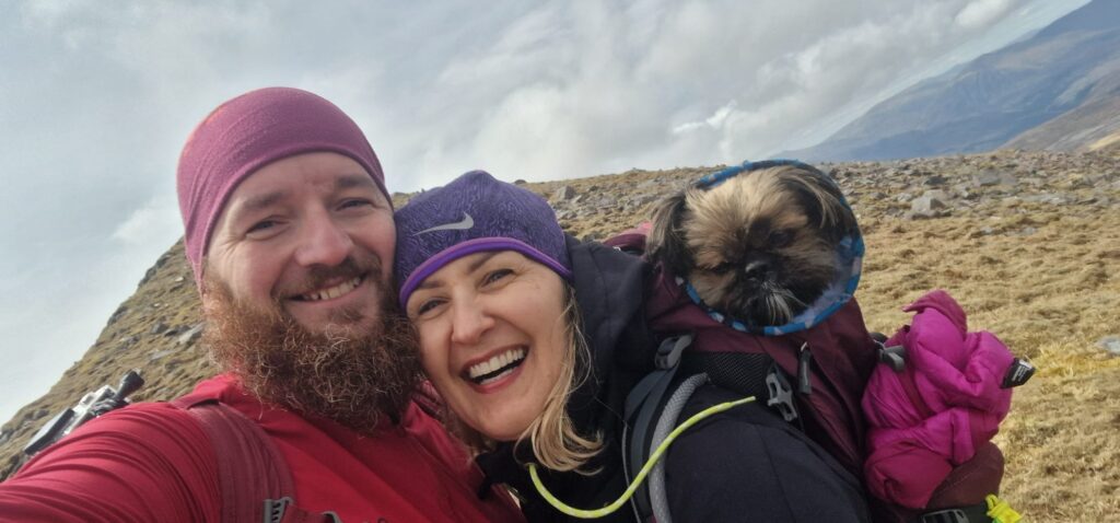
Robert was waiting for me at the hotel to walk with me for a few precious minutes and share a coffee together. It was one of those beautiful moments on the trail that gave me strength again, and I was so happy to curl up for a moment beside the man I love.
Of course, this was also where I changed the dressings on my aching feet so I could continue.
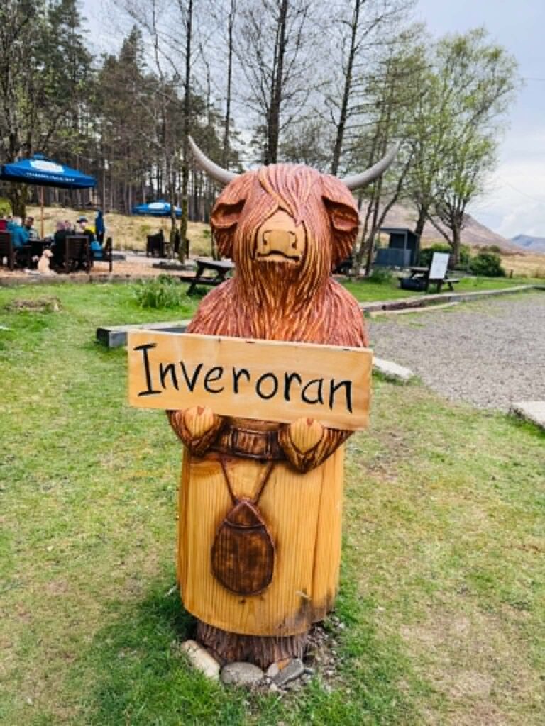
From Bridge of Orchy to Inveroran, the route became wide once again.
Along the way, I climbed the small hill of Mam Carraigh. The ascent is not particularly steep, but from the top there is a stunning panorama overlooking Loch Tulla and the mountains surrounding Black Mount.
Behind me stood Beinn Dorain (1,076 m).
And inside my mind — memories of Tobi.
We had been here many times before… camping, climbing Munros, exploring the Highlands together.
Tears welled in my eyes again and again.
That was when I realised that the second stage of the WHW was becoming the most sentimental journey of all, because these places held so many shared memories:
Tobi.
Robert.
And me.
When I reached Inveroran, I did not want to stop.
There were still 16 km remaining to Glencoe Ski Resort.
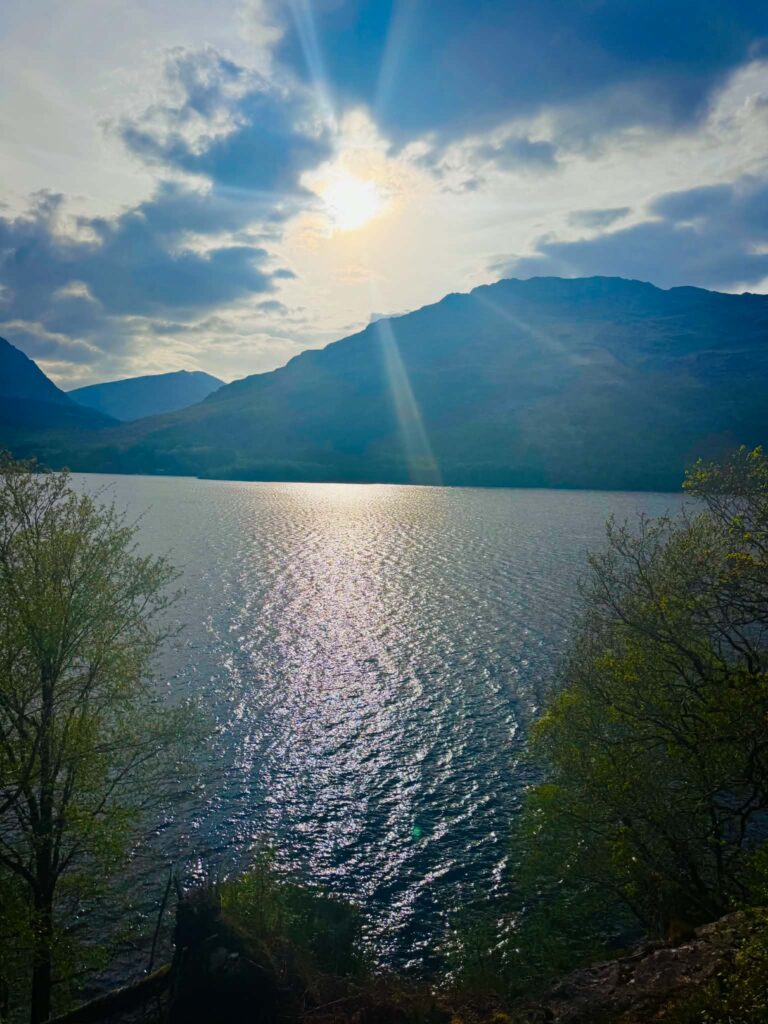
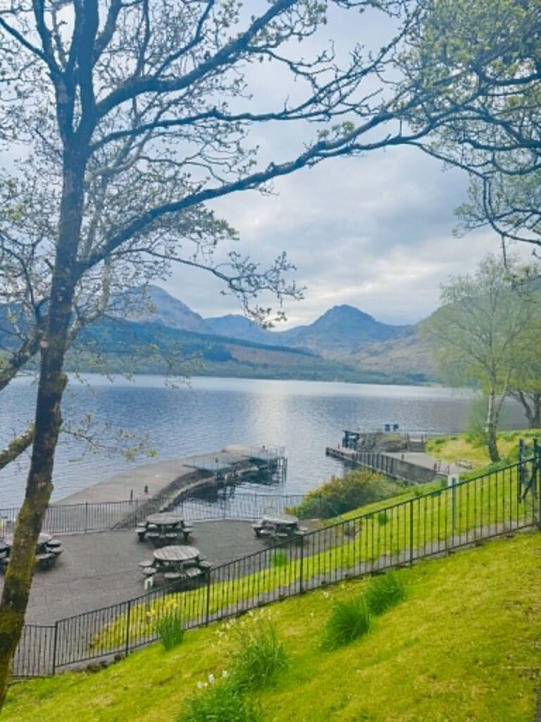
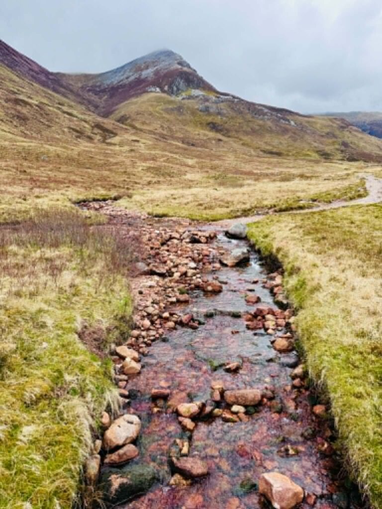
This section crosses the legendary Rannoch Moor — a vast, uninhabited peat bog considered one of the last truly wild places in Scotland.
Robert had already arrived there and used his drone to capture beautiful aerial photographs.
I tried to find myself in them — unsuccessfully 😊
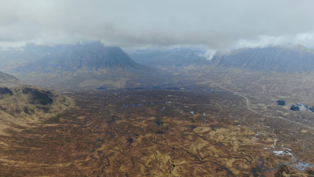
The landscape was stark and dramatic, with dark clouds gathering in the distance.
The old stone road, built in the 18th century and surrounded by countless lochans and towering peaks, twisted gently through the wilderness and was surprisingly pleasant to walk.
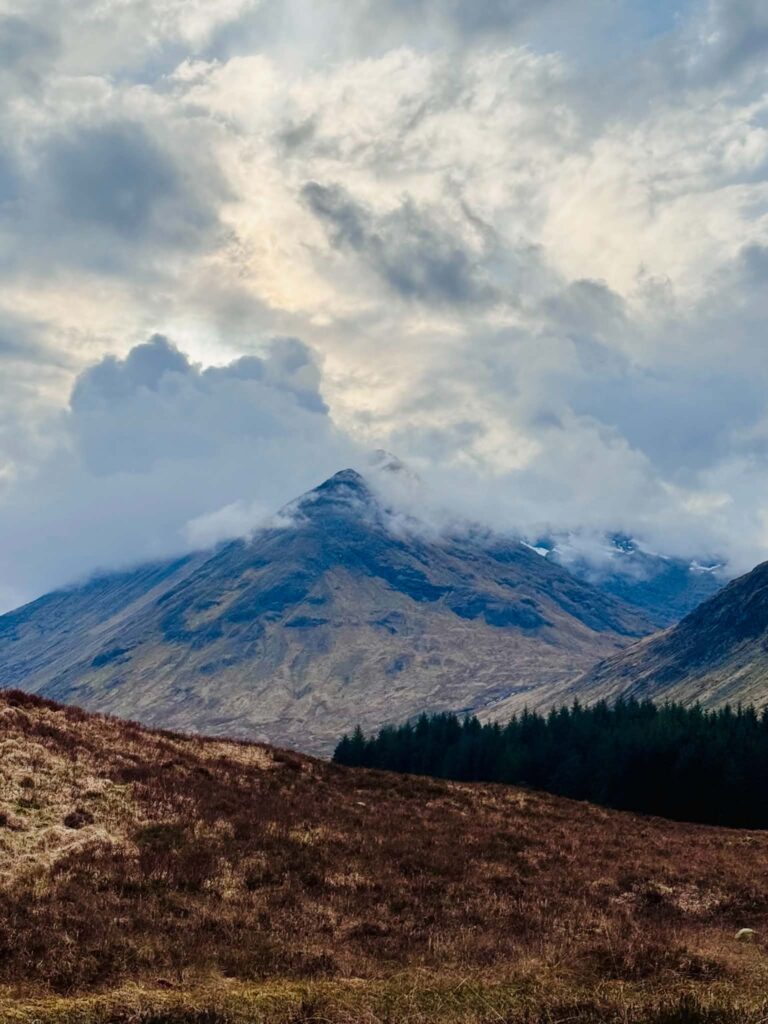
As I approached Glencoe, I could see Buachaille Etive Mòr in the distance — Scotland’s most iconic and most photographed mountain, famous for its perfect pyramid shape.
The final stretch of the route became yet another memory of walking there with Tobi.
I could feel his presence beside me.
Here.
Now.
As I entered the car park, I suddenly saw a black-and-white dog running towards me.
He greeted me enthusiastically and rolled onto his back, asking for belly rubs.
I felt so happy, because deep down I knew it was another sign from Tobi.
After a short while, I led him back to his owners.
They were surprised he had wandered so far away…
Yes.
That was Tobi 😊
A hot shower and fresh bandages eased my suffering as a weary traveller 😊
Warm tea and falling asleep wrapped in Robert’s arms helped me rest.
During the night, heavy rain woke me up.
It hammered against the roof until morning.
Looks like another lovely day ahead.
Ah… Scottish weather.
STAGE III / DAY 3
Glencoe – Fort William – my 43 km
At 6 a.m., the alarm rang.
The endless rain made me lose all motivation to continue walking.
My aching feet did too.
The hoarseness and sore throat that had accompanied me since Day One were becoming increasingly difficult to ignore.
The thought crept back into my mind once again:
“I’m not going.”
But not for long.
The smell of coffee gave me energy again.
And once I drank it, I simply pulled myself together.
Today’s route included the Devil’s Staircase.
I was curious about that.
What kind of devil was waiting for me there?
People had warned me it was another difficult section of the trail.
Then, on the map, there was Kinlochleven — my favourite little village, which we had visited several times with Tobi.
And finally, the long-awaited finish line.
From Glencoe Ski Resort to the famous Kingshouse Hotel was only 2 km.
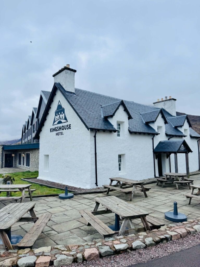
Around the hotel I could see tents and sleepy hikers slowly waking up. A few people were already out on the trail.
When I reached the Devil’s Staircase, I decided to eat breakfast.
A banana and a protein bar 😊
Perfect.
A guilt-free sweet breakfast.
“I’ll burn it all off in a moment anyway,” I laughed to myself while looking at those infamous “devilish stairs.”
And finally — there they were.
So what exactly are the Devil’s Staircase?
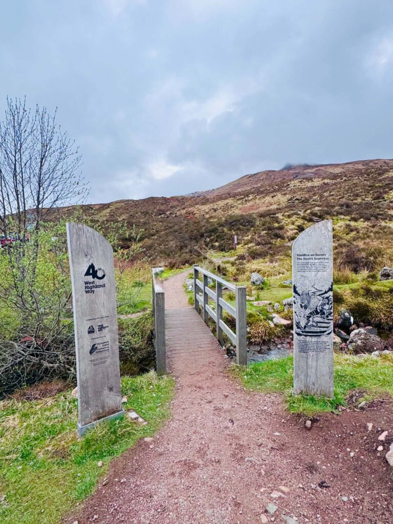
The name was given by the soldiers who built this military road in the 18th century. Carrying construction materials up such a steep incline must have felt like absolute hell.
Later, the name became famous thanks to workers from the Kinlochleven hydroelectric plant, who often returned this way in winter after spending their wages in nearby pubs.
Despite the intimidating name, the Devil’s Staircase is actually a well-built zigzagging trail.
The climb is exhausting, but technically safe.
The summit reaches 550 m above sea level — the highest point on the entire West Highland Way.
And the views from the top are breathtaking.
Behind me lay the harsh valley of Glencoe.
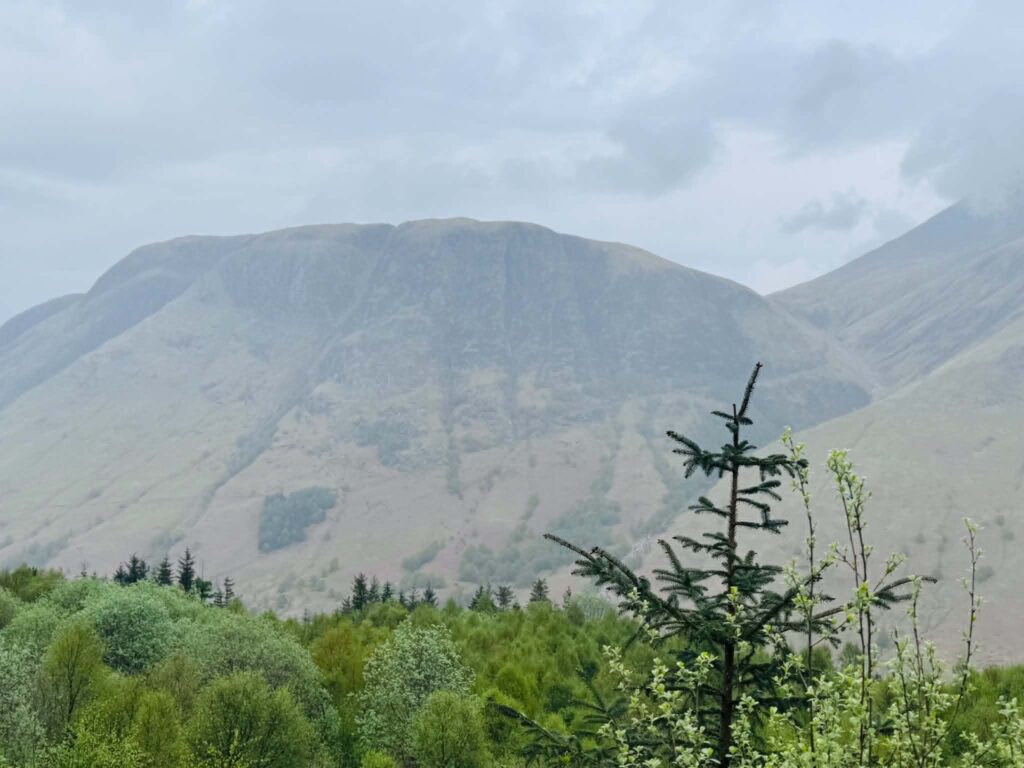
Ahead stretched the Mamores mountain range and, in the distance, the towering summit of Ben Nevis (1,345 m above sea level), the highest mountain in Scotland.
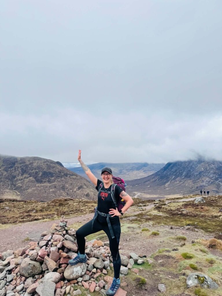
I practically ran up the Devil’s Staircase.
I did not want to stop.
If this was the only true challenge of today’s route, then I wanted to conquer it as quickly as possible.
At the top — a souvenir photograph and a few quiet moments to admire the magnificent views.
The descent was easy and beautiful until the gravel road appeared, following the large pipes carrying water down to the hydroelectric station below.
Kinlochleven is a village with a deeply industrial history, once famous for aluminium production, which earned it the nickname “Electric Village,” as it became the first village in Britain with electric street lighting.
The village lies in an extraordinarily dramatic setting, almost squeezed between two massive mountain ranges at the end of Loch Leven sea loch.
I love this little village dearly, so I want to write a little more about it.
From Kinlochleven, you can see the Mamores to the north — a mighty mountain range separating Kinlochleven from Glen Nevis.
There are ten Munros there (mountains over 914 m), including the distinctive pyramid-shaped Binnein Mòr (1,130 m).
To the south rise the mountains of Glencoe.
Looking back in the direction from which I had arrived along the WHW, you can see the northern slopes of the Aonach Eagach ridge — widely regarded as the narrowest, most exposed, and most difficult ridge in the entire United Kingdom.
The ridge links two Munros:
- Meall Dearg (953 m)
- Sgùrr nam Fiannaidh (967 m)
The village is also home to the beautiful Grey Mare’s Tail waterfall.
It lies only around ten minutes from the centre.
Water plunges over 50 metres into a deep, forested gorge.
One of the greatest attractions here is the via ferrata.
Yes — Scotland has its own iron path 😊
Visitors can climb vertical rock faces beside the waterfall using steel cables and ladders attached directly to the cliffs.
It is considered one of the most exciting outdoor adventures anywhere along the trail.
For nearly two decades, Kinlochleven was also home to the world’s largest indoor ice climbing wall.
Inside the old aluminium smelter, engineers created a gigantic refrigerated chamber filled with 500 tonnes of real snow and ice.
Climbers from all over the world travelled here to train with ice axes in temperatures of -6°C, regardless of Scotland’s unpredictable weather outside.
Sadly, after a devastating fire in 2022, this legendary facility closed permanently.
Today, the building remains only as a monument to its former glory — a reminder of how Kinlochleven transformed its industrial past into modern adventure tourism.
It is such a shame I never had the chance to try it myself.
Alright… back to my WHW adventure.
Robert was waiting for me in Kinlochleven, and I was incredibly grateful that I could eat the delicious lunch I had left in the fridge earlier.
My favourite bread roll 😊
How could I possibly have forgotten it?
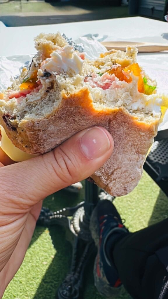
Once again, my support team proved invaluable 😊
And for dessert — pistachio ice cream.
My favourite flavour.
Refuelled and happy, I set off on the final stage of the journey.
I said goodbye to a place filled with beautiful memories.
Everywhere I looked, I could almost see Tobi walking beside me through the pretty streets and the park.
Now he accompanied me once more as I climbed onward towards Fort William.
The final stage from Kinlochleven to Fort William is a worthy conclusion to the entire journey.
It measures roughly 24 km, and although your legs feel every kilometre already walked, the scenery refuses to let you think about the pain.
After a short climb, the route enters Lairigmòr — “The Great Pass.”
A vast valley surrounded by the mighty peaks of the Mamores.
Open space.
Silence.
Endless mountains.
Runners and cyclists passed me along the way.
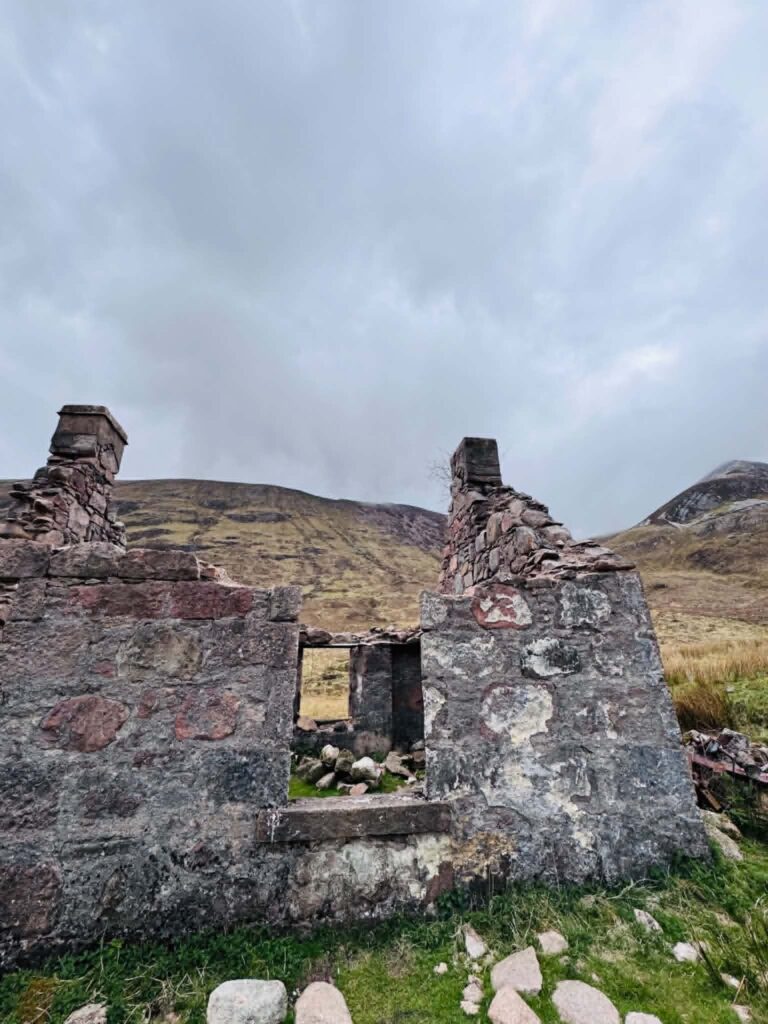
I also walked past the ruins of Dun Deardail, the remains of an Iron Age fort.
The road seemed endless.
At times, it felt like the longest section of the entire trail.
A cold wind accompanied me through the harsh mountain landscape.
“How much farther?” I kept thinking.
Then suddenly, around one bend, the scenery changed completely.
The route descended through forests into Glen Nevis, with views of the majestic Ben Nevis (1,345 m), hidden partly in clouds, with patches of snow still visible high on its summit.
I barely even noticed the rain anymore.
I could think only of one thing:
Something was ending.
And something else was beginning.
The finish line was already somewhere on the horizon.
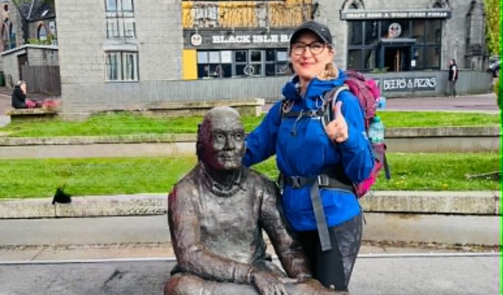
When I finally entered Fort William and walked through the town centre towards the famous “Man with Sore Feet” statue — the official end point of the West Highland Way — I felt emptiness.
Immense emptiness.
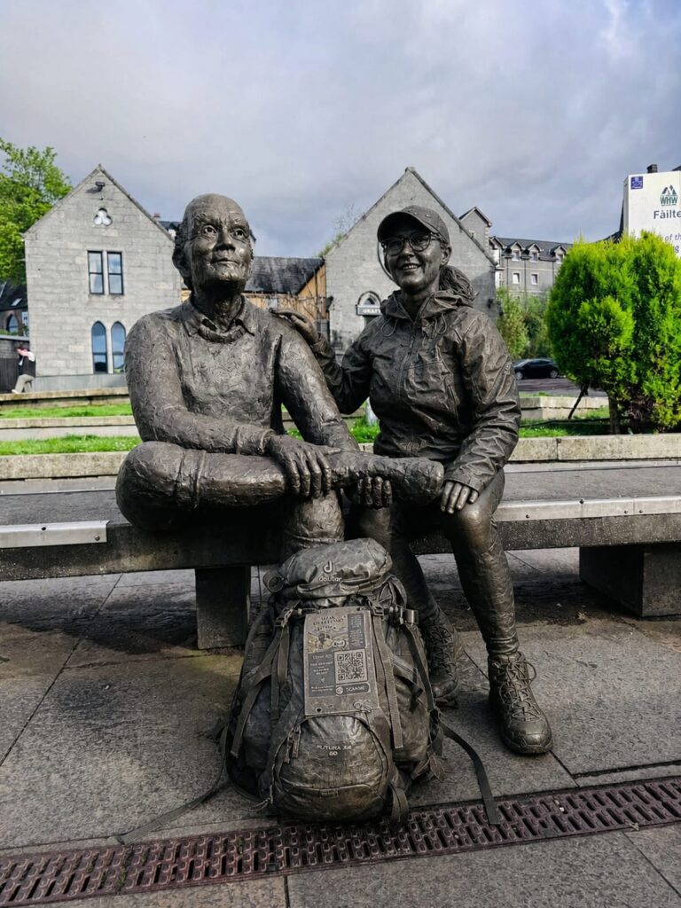
“The Man with Sore Feet” is the famous bronze sculpture of an exhausted hiker sitting on a bench and massaging his aching foot.
He represents the pain, blisters, exhaustion — but also the overwhelming satisfaction of reaching the end.
The creator of the trail, Tom Hunter, has his own statue too, but it stands at the very beginning of the route in Milngavie.
It depicts a hiker stepping onto the trail and is often simply called “The Start.”
But the man in Fort William represents all of us who have completed the journey.
I sat beside him.
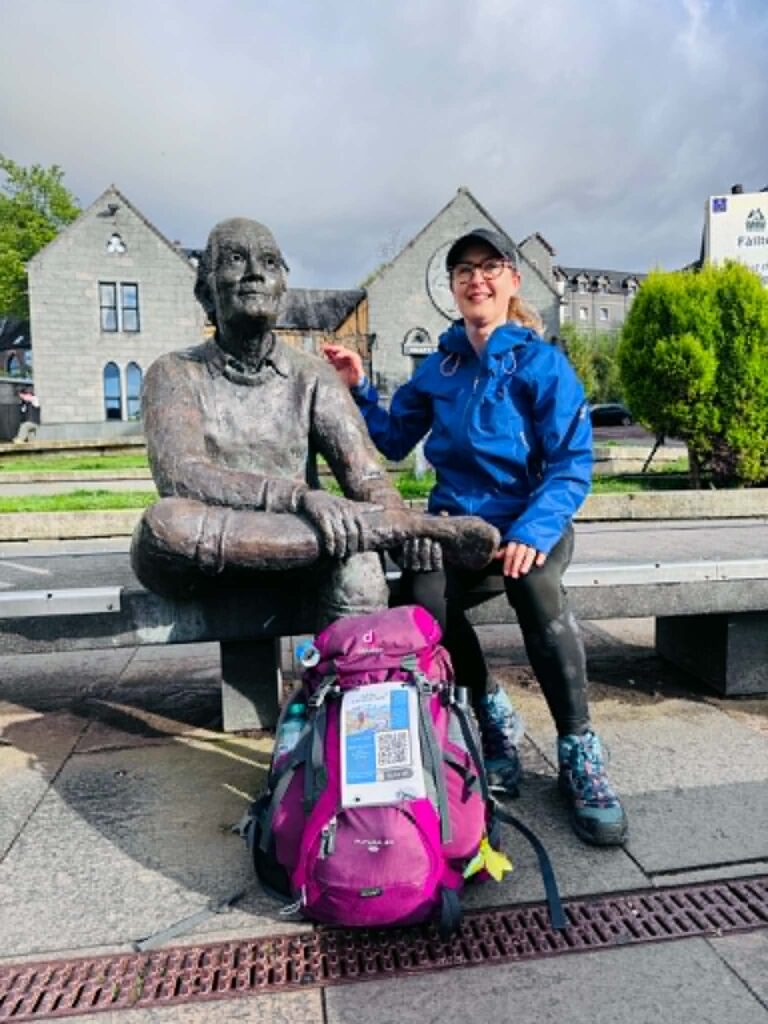
And suddenly, overwhelming sadness washed over me.
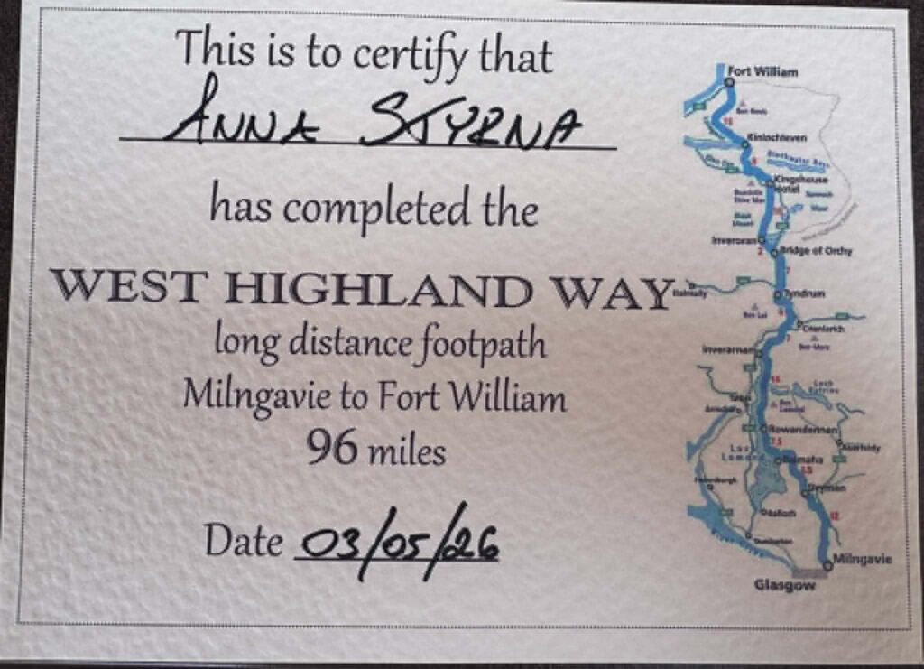
My beloved Robert handed me my WHW completion certificate.
He took one final photograph.
He hugged me.
And congratulated me.
We returned to the motorhome, and I began to cry.
I miss Tobi so much.
This journey was for him.
In memory of my beloved dog, Tobi.
Robert held me close.
“Darling, you did it. Tobi is proud of you — and so am I. You know he is always with us and forever in our hearts.”
(…)
Conclusion
The three-day WHW challenge was also a fundraiser for the Scottish SPCA and dogs in need — though I originally thought it had already come to an end.
Tobi raised £665.
The original goal had been £500.
But perhaps we can raise even more, if you would also like to help.
I realised that I do not want this story to end.
My journey continues.
And one day, I will meet Tobi again beyond the Rainbow Bridge.
So let the fundraiser continue too.
If you would like to support it, you can do so here:
https://scottishspca.enthuse.com/pf/tobi
All donations go directly to the organisation.
And if you have your own idea for a charity walk or fundraiser, please let me know.
Share your story with me.
I would be deeply grateful.

Do You Want to Walk the West Highland Way?
Believe me — you can do it too.
It is worth it.
For the views.
For the silence.
And for yourself.
Maybe you want to complete it in three days 😊
Maybe it will take you five, eight, or even more.
That is not what matters most.
One thing is certain:
You will return a different person.
Changed.
Filled with respect for the power of nature, Mother Earth, and the incredible strength of your own body.
It does not matter whether you carry your entire kit on your back and sleep in a tent, or choose farm stays, campsites, or hotels.
It does not matter whether you walk for a charitable cause or simply because you need time alone with your thoughts.
What matters most is that you dare to follow your dreams — and that with every kilometre of this journey, and every step through life, you remain a kind and good human being.
That is my wish for you.